Trails
Levada do Barreiro (PR4)
From the 1813 ice house to a levada with views over Funchal

The place
Levada do Barreiro is the official PR4, a one-way route that starts at the Poço da Neve on the ER 202, the road to Pico do Areeiro, and is run by Funchal's municipal council. The route's panel, drawn for the original line to Casa do Barreiro, gives 5.2 km, about 2 hours 10 minutes and heights between 975 m and 1,650 m. IFCN lists the route as partly passable on 4 November 2026, and according to the council's reopening map, the route as reopened in 2025 ends at Ribeira das Cales; check before you go.
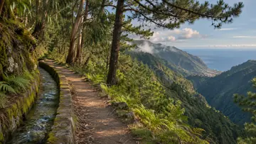
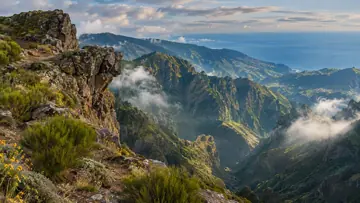
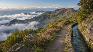
The Poço da Neve was built in 1813 so that snow and hail from the occasional winter fall could be kept as ice all year, and the ice was carried down to Funchal on foot. From there the path descends through tree heath and other high-mountain plants, crosses an asphalt road after 400 m and follows a feeder channel to the Ribeira dos Frades valley, where the Levada do Barreiro takes its water. It then follows the levada along the left bank of the Ribeira de Santa Luzia valley, with wide views over Funchal from several viewing spots.
Highlights
- The route starts at the Poço da Neve, an ice house built in 1813 whose ice was carried on foot down to Funchal.
- A feeder channel leads to the Ribeira dos Frades valley, where the Levada do Barreiro takes its water.
- The levada runs along the left bank of the Ribeira de Santa Luzia valley, with viewing spots over Funchal.
When to come
Check first how much of the route is open. Then pick a dry day, as the narrow levada path is slippery when wet and has exposed passages.
Getting there
The route starts at the Poço da Neve on the ER 202, the road to Pico do Areeiro, where the panel map shows an information panel and a viewpoint; the PR3 Vereda do Burro passes close by. According to the council's reopening map, the route as reopened in 2025 ends at Ribeira das Cales: check before you go, and plan how to get back from there.
Worth knowing
- Status: IFCN lists the route as partly passable on 4 November 2026; according to the council's reopening map, the route as reopened in 2025 ends at Ribeira das Cales, so check before you go.
- Distance and time: 5.2 km one way and about 2 hours 10 minutes, with a steep descent of 680 m; these are the panel's figures for the original route to Casa do Barreiro.
- Heights: between 975 m and 1,650 m on the panel's route.
- Difficulty: easy by Visit Madeira's rating, though parts of the levada path are narrow and exposed.
- Caution: the route crosses a road with traffic after 400 m.
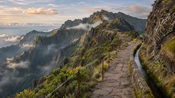
- Caution: the path beside the Levada do Barreiro is narrow, uneven in places and partly slippery, above all when wet.
- Caution: there are exposed passages along the levada, some with railings, and the slopes are steep all the way.